


 Numerous parts of Nebraska experienced much needed rainfall over night, with potentially more on the horizon.
Although, National Weather Service Meteorologist Cory Mead says singular events like last night do not make a significant impact on the extreme drought conditions facing parts of eastern Nebraska, but it does move us into the right direction for recovery.
There was fairly wide rainfall across the state. Especially south of the Platte river, in eastern Nebraska, and southwest Iowa. Upwards of 1″ to 1.5″ of rain graced Omaha and Lincoln, with some higher numbers reported around the area, stretching into Iowa.
Tonight, we could expect a similar scenario. Mead says storms will develop over western parts of Nebraska this afternoon into the evening, and grow into a larger storm complex over central Nebraska tonight, moving into eastern Nebraska by late Thursday night into Friday morning. These conditions may skew more northern then last night, still providing much needed moisture.
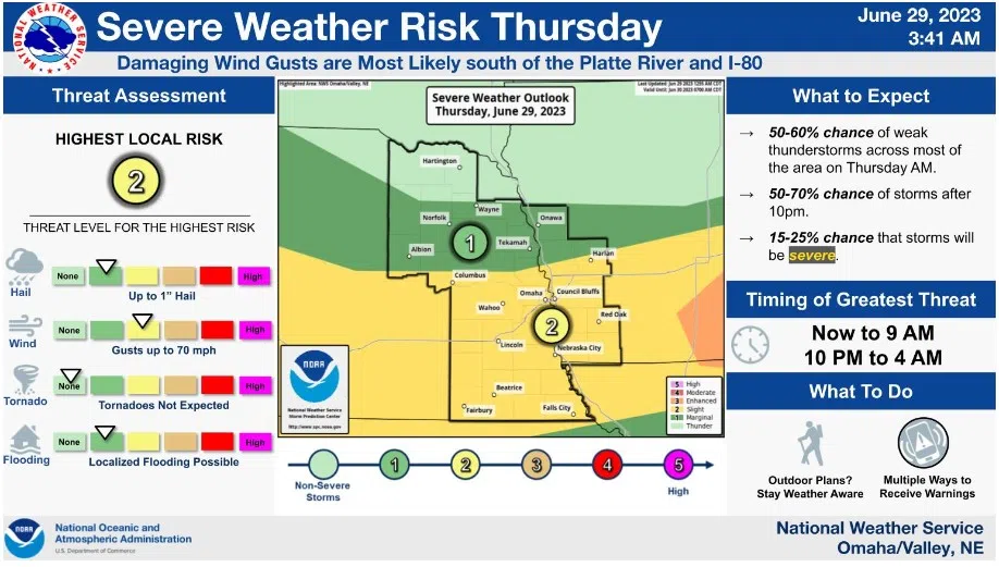
Some severe weather conditions are anticipated. Potential quarter sized hail, wind gusts of 60 miles per hour, and potential for localized flooding due to the rainfall.
(Photo Courtesy: National Weather Service)