


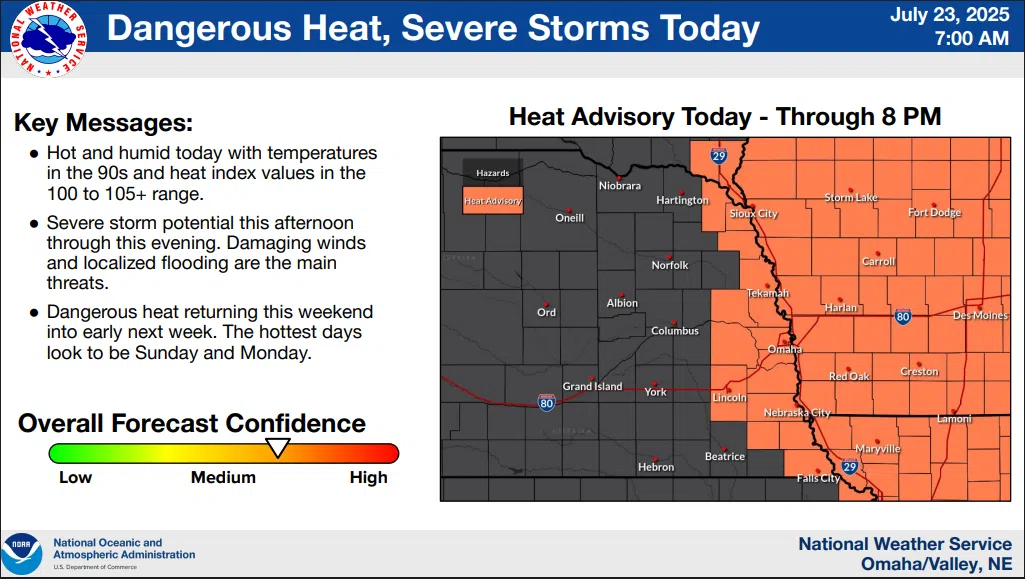
…HEAT ADVISORY IN EFFECT FROM NOON TO 8 PM…
NWS 7-23-25 7a
Today and Tonight
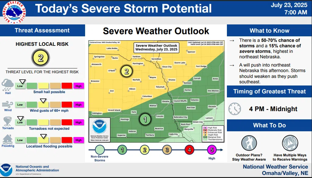
Dangerous heat continues Wednesday with heat indices up to 100-106, highest in far eastern Nebraska and southwest Iowa.
There is a 50-80% chance of storms Wednesday afternoon into Wednesday night, with a 15-20% chance of some severe storms, mainly in northeast Nebraska. Damaging winds and localized flooding will be the primary threats.
Thursday through Tuesday
Repeated rounds of showers and thunderstorms could bring increased risk for localized flooding. Another round of dangerous heat is possible late this weekend into early next week.
Additional details are available here 7-23-25 NWS AM DssPacket