


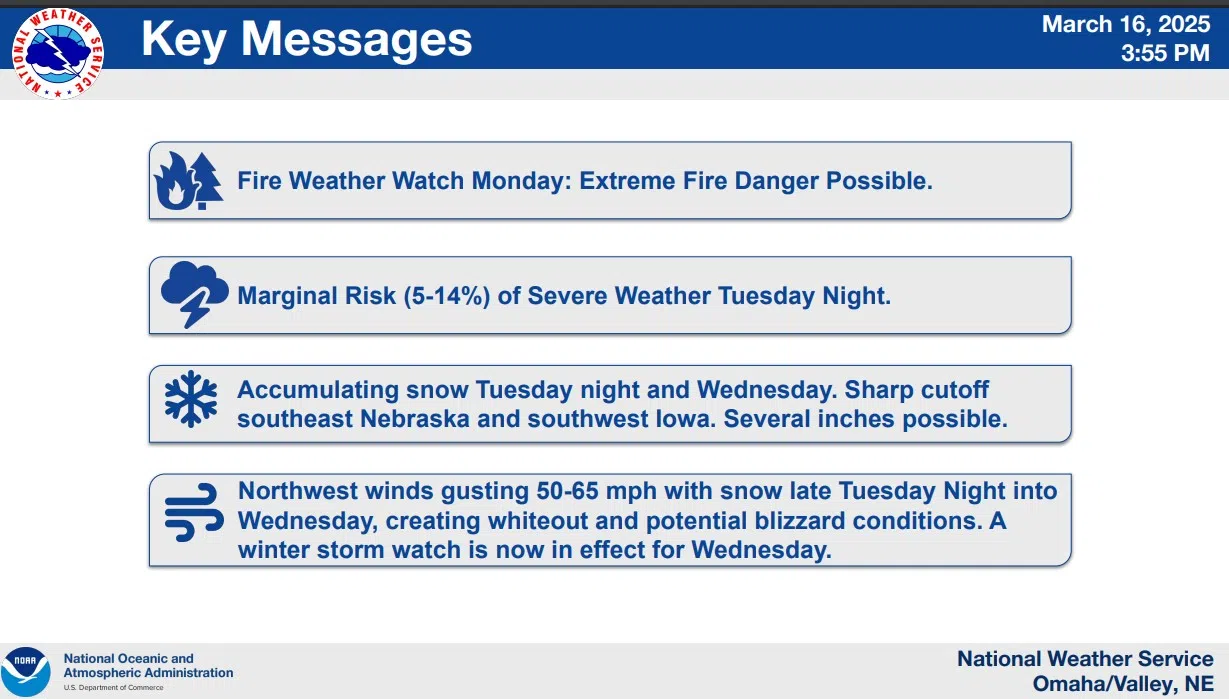
…FIRE WEATHER WATCH IN EFFECT FROM MONDAY MORNING THROUGH MONDAY EVENING FOR WIND AND LOW RELATIVE HUMIDITY FOR MUCH OF NORTHEAST, EAST CENTRAL, AND SOUTHEAST NEBRASKA, AND SOUTHWEST IOWA..
Monday late morning hours will experience sustained Southwest winds of 15 to 25 mph with gusts 30 to 40 mph. In the afternoon west winds sustained 15 to 25 mph are expected with gusts of 25 to 35 mph likely. That combined with very low relative humidity (as low as 10 to 16 percent across the entire area) will contribute to any fires that develop which would allow fires to spread rapidly. Outdoor burning should be avoided.
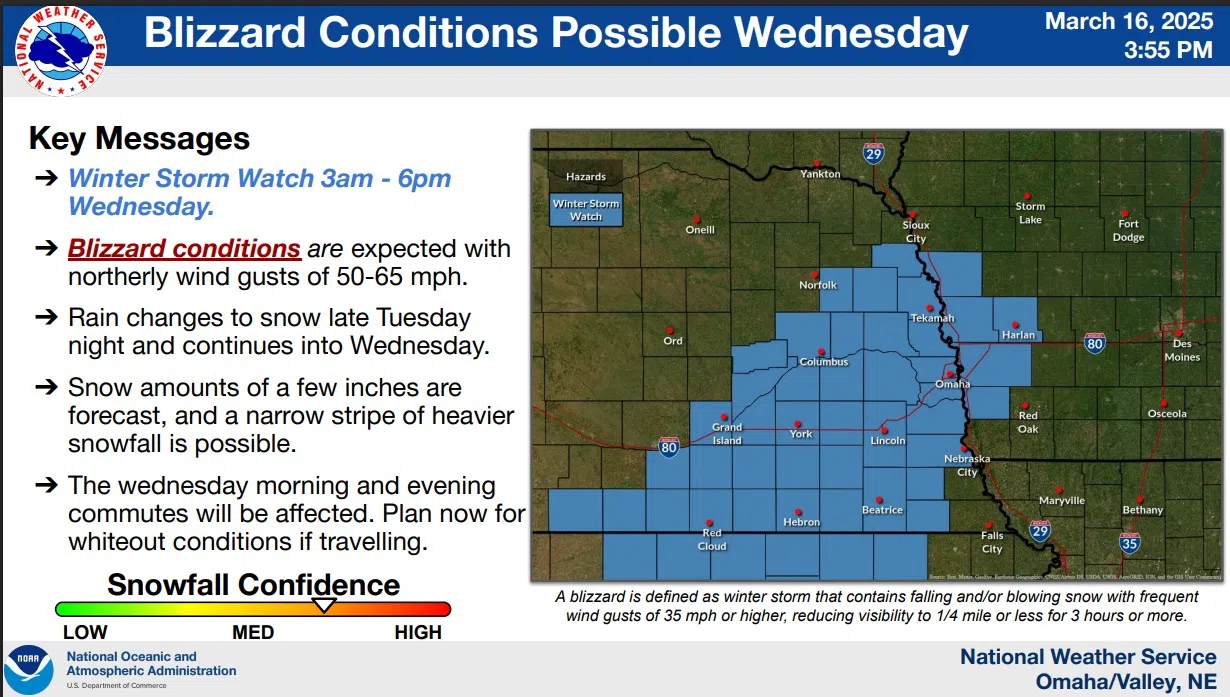
An approaching storm system is expected to bring wintry conditions to the area by midweek.
…WINTER STORM WATCH IN EFFECT FROM LATE TUESDAY NIGHT THROUGH WEDNESDAY EVENING…
Blizzard conditions are possible with expected snow accumulations of two to five inches possible. Winds could frequently gust 50 to 60 mph across portions of southwest and west central Iowa and east central, northeast, and southeast Nebraska.
Visibilities may drop below 1/4 mile due to falling and blowing snow with whiteout conditions possible at times. The strong winds and weight of snow on tree limbs may down power lines and could cause sporadic power outages.
Prepare for possible blizzard conditions. Consider adjusting travel plans. Continue to monitor the latest forecasts for updates on this situation.
3-16-25 NWS