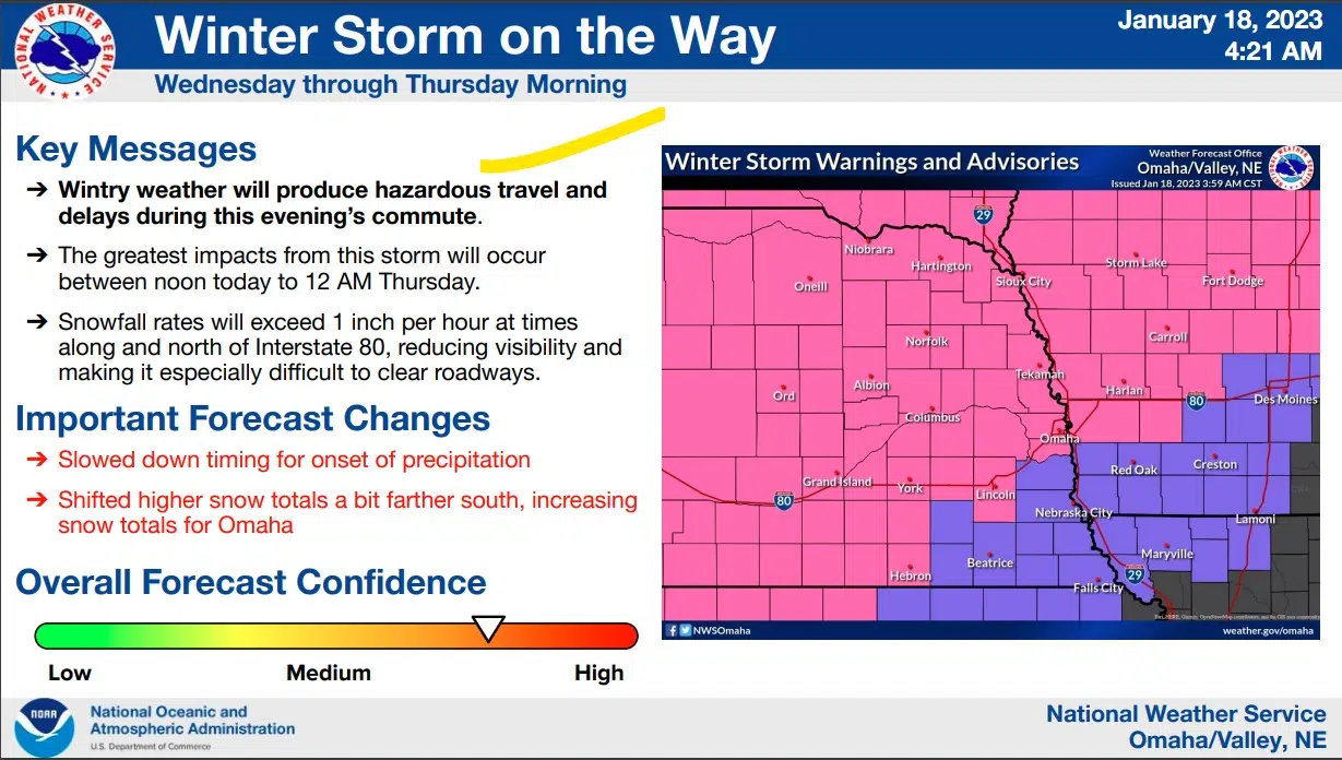
 Significant snowfall is expected to bring deteriorating travel conditions to the area through the day Wednesday. Snowfall rates could reach 1-2 inches per hour at times, especially in northeast Nebraska.
Peak snowfall amounts in the area are expected to be between 6 to 14 inches. Light icing (as high as 0.20″) is possible in southeast Nebraska and southwest Iowa. Expect hazardous travel conditions for the Wednesday evening commute.
Snowfall is expected to come to an end by 8 AM Thursday morning. Expect hazardous travel conditions for the Thursday morning commute.
The latest National Weather Service summary indicates the storm system has slowed down and the area of heavier snow area has moved a bit South, increasing the amounts expected in the Omaha Metro.
Additional NWS info is available here 1-18-23 NWS AM DssPacket
…WINTER STORM WARNING REMAINS IN EFFECT UNTIL 6 AM CST THURSDAY…
* WHAT…Heavy mixed precipitation expected. Total snow accumulations of 5 to 9 inches along I 80 and 8 to 14 inches north of the Platte River and ice accumulations of around two tenths of an inch. Winds gusting as high as 35 mph.
* WHERE…Portions of southwest and west central Iowa and east central, northeast and southeast Nebraska.
* IMPACTS…Travel could be very difficult to impossible. The hazardous conditions could impact the morning or evening commute.
PRECAUTIONARY/PREPAREDNESS ACTIONS… If you must travel, keep an extra flashlight, food, and water in your vehicle in case of an emergency. The latest road conditions for the state you are calling from can be obtained by calling 5 1 1.


